Advancing Polylabel: Enhanced Geometry for Optimal Polygon Label Placement
Leaflet Polylabel
Enhanced Geometry for Optimal Polygon Label Placement
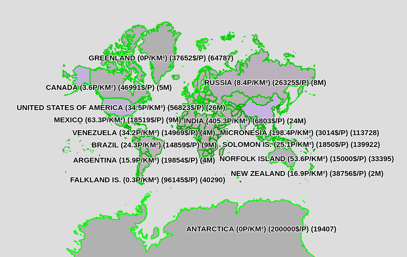
In the realm of cartography and data visualization, placing labels within polygons has always been a challenge. Traditional methods often struggle with finding the ideal spot for labels, especially when polygons are irregular or wide. Enter Polylabel, a groundbreaking algorithm designed to determine the optimal label placement using the concept of the pole of inaccessibility — the furthest internal point from a polygon's outline.
Polylabel: A Revolution in Label Placement
Polylabel has set a new standard for placing labels within polygons. By identifying the pole of inaccessibility, it ensures that labels are centrally located, maximizing readability and visual clarity. This approach has been widely adopted in mapping applications and geographic information systems (GIS), where precise labeling is crucial.
Pushing the Boundaries of Label Placement
Building upon the foundation laid by Polylabel, our team has embarked on an ambitious journey to enhance label placement even further. We've extended the algorithm's capabilities by integrating advanced geometry techniques. This enhancement allows Polylabel to accommodate wider labels without compromising placement accuracy.
Introducing Collision Detection with Leaflet-labeler Logic
One of the key challenges in label placement is avoiding overlap. To address this, we've integrated the collision detection logic from Leaflet-labeler into Polylabel. This addition ensures that labels do not overlap, maintaining readability and preventing visual clutter.
Benefits of Our Approach
Our enhanced Polylabel algorithm offers several advantages:
Improved Placement Accuracy: Labels are placed more precisely, even for wide polygons.
Enhanced Readability: Labels are centrally positioned for optimal visibility.
Collision Avoidance: Labels do not overlap, preserving map clarity.
Real-World Applications
These advancements have profound implications across various industries:
Mapping and GIS: Accurate label placement enhances the usability of maps and spatial data.
Urban Planning: Clear labeling improves the communication of urban development plans.
Environmental Mapping: Precise labels aid in understanding and conserving natural landscapes.
Conclusion
In conclusion, our enhanced Polylabel algorithm represents a significant leap forward in the field of label placement within polygons. By leveraging advanced geometry and collision detection techniques, we've made strides towards ensuring that labels are not only placed accurately but also enhance the overall visual appeal of maps and data visualizations.
Stay tuned as we continue to refine and innovate, pushing the boundaries of what's possible in polygon label placement.
Check it out today!
Put Your Project on the Map with Expert GIS Services!
Ready to bring your spatial data to life? Whether you need custom maps, spatial analysis, or seamless GIS solutions, we've got you covered. With over 25 years of industry experience and proficiency in all GIS software, we make spatial simple and stress-free.
Why Choose Us?
Custom Solutions: Tailored GIS services to meet your unique needs.
Tech Proficiency: We know ALL the tools to deliver the best solutions.
Full Service: From office to field, we handle all your spatial challenges.
Beautiful Deliverables: Our maps and analyses are not just functional but beautifully crafted.
Get Started Today!
Submit your email to request a project and let us take your GIS project from concept to reality. Together, we'll elevate your spatial data to new heights!
ABOUT
ENDpoint Ventures is building the future of cloud first geo-spatial and AI solutions. Unleash your data with our inclusive affordable solutions for your data and your business
When you dont know, you know, We deliver.


